Geology

Geologically in Perambalur district, western part is covered by hard rocks, south east by cretaceous formation, thin fringe of Gondwana in south and north Alluvium.
The western part of the district is covered by Granitic gneiss, Hornblends gneiss, harnockite with intrusions of Dolerite – dykes and pegmatites. These rocks are highly metamorphosed and have been subjected to very severed folding, crushing and faulting.
Nearly 75% of the area in this district is covered by sedimentary formations like the ancient upper thin fringe of Gondwana (underlined by hard rock), cretaceous, Tertiary and Recent alluvial deposits. The Upper Gondwana occurs as a thin fringe composing of clay sandstone underlain by the hard rock.
The cretaceous formation deposited under marine conditions. The sequence of cretaceous beds commences with Uttatur stage, Ariyalur stages and closed with Ninniyur stage. These beds consists of shales, clay, limetone, argillaceous limestone, coral limestones and shell limestones. The Tertiary Miocene and Pliocene age formation is underlain by Cuddalore sand stoned. The formation consists of sand stones, gravelly sand, clays, lignite seam and pebble beds, marine regressions are indicated by intercalation of lignite beds. The cretaceous formations stretch along the river coursed of Coleroon, Marudaiyar and Vellar. They are mainly composed of Alluvial deposits which are medium to coarse grained sediments and finer flood plain deposits. The Quaternary alluvium is underlain by the Archaen and also the Cretaceous formation in Kunnam Taluk.

Company Statistics Analysis

Great Achievement For Insurance

8563 +

Saticfied Custimer

2630 +

Experience Members

100 %

Satisfaction Rate

25 +

Years Experience

963 +

Awards Winning

Popular Clients

We’ve 1520+ Global Premium Clients

Sathanur National Fossil Wood Park

Geological study shows that more than 120,000,000 years ago, the sea (which lies today about 100 k.m. East of Sathanur) had transgressed as far as 8 to 10 km West of Sathanur. During this period which is Geologically known as the cretaceous, the sea abounded in a variety of marine animals similar to those found in the present day sea. These animals, after death, sank to the bottom and were buried by sand and clay brought down by the rivers. Along with them some of the trees which flourished on the seacoast or near shore were also buried after transport by flooded streams and were petrified in course of time.

The large trunk of petrified tree, which can be seen here, lies within the Trichirappalli group of rocks of about 100,000,000 years ago. This tree shows the presence of Conifers (The non flowering plants) that dominated the land vegetation prior to the advent of Angiospems (the flowering plants of the present day).
The petrified tree trunk at Sathanur measures over 18 meters in length. Similar fossil trees measuring a few meters in length are found along the stream sections near Varagur, Anaipadi, Alundalipur and Saradamangalam. Dr.M.S.Krishnan of the Geological Survey of India first reported this fossil tree in 1940.

An educational center, including a museum and a children’s park exists at the National Fossil Wood Park at Sathanur. Named as Sathanur Petrified Tree Educational Center, this would provide information and also raise awareness among visitors on the importance of the fossil tree at the site and the region as well. The Education Center constructed as part of the project includes four halls with illustrations on the solar system, origin of earth, big bang theory, origin of life and evolution and the petrified tree. Fossils collected in the region have been displayed in the museum.

Karai Badland Topography

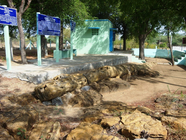
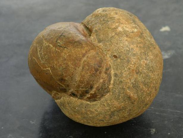
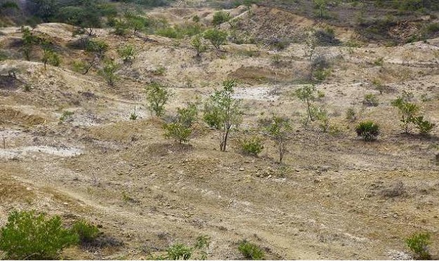
The Karai Badlands national geological monument is located in the Karai area along the Karai-Kulakkalnattam road of Perambalur District, Tamil Nadu. A four km. the stretch of badlands with natural conical mounds and typical fossils of Cretaceous age is exposed as badlands with a series of conical mounds separated by gulleys.
Badland topography, on either side of Alattur-Ariyalur road, spread within 40-70 km. radius marks the lower part of marine Cretaceous rocks that mainly consists of clay & sandstone of Karai Formation. Like the Grand Canyon in Colorado, US, Ariyalur is considered as a Cretaceous Park of South India by the Geo-scientist.
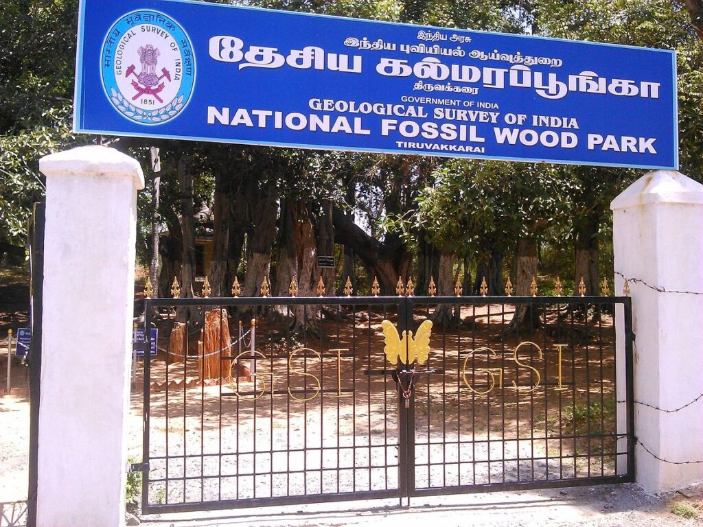
Geological Survey of India (GSI), has declared Karai Badland as a National Geological monument for its maintenance, protection, promotion, and enhancement of geo-tourism.
The Rock formation is here exposed of Cretaceous of Trichinopoly, Which dates back to the Late Cretaceous. The Succession in the area is broadly divided into 4 Groups -Uttathur, Trichinopoly, Ariyalur, and Ninniyur, Where the Uttathur is the oldest. After comparing the age and color of the rock formations here with those of the Himalayas, we have found that they are of the same age. The Karai Formation of Uttatur Group at Karai-Kulakkalnattam section in Perambalur district forms the lower part of the Cretaceous sedimentary succession of the Cauvery Basin.